About Ground Truth Survey
Ground Truth Survey is an initiative to fill the gap in GIS/Remote Sensing field to help people in space technology for Earth Science & its applications. Determined by the requirements of clients and supported by the expertise of our vast experience in Government sectors and Consultancy based work in the GIS field, the solutions we offer are motivated on providing you with a wide-ranging world-class service.
If you are taking up a GIS project, require specific GIS solutions for your tasks and need any kind of support, or don’t know where to get started, get in touch with us to get help from our experts.
Benefits of GIS Mapping Services
Types of GIS Mapping Services Include
Topographical Mapping
Topographical mapping enables industries when it comes to selection of the smartest route from one place to another. In Topographical mapping we map terrain with contour lines to understand an area’s elevation in a better way. Topographic maps are used for energy exploration, natural resource conservation, public works design, environmental management, commercial as well as residential planning, etc.

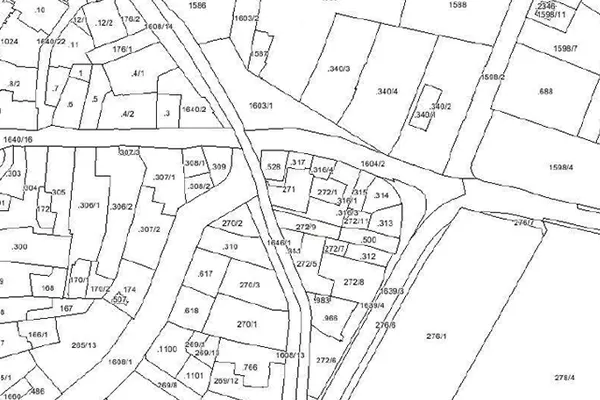
Parcel Mapping
Parcel mapping is the method in which land parcels are prepared using GIS mapping for effective and precise land management. Parcel mapping has a variety of implementations over various industries like land administration & land registration by urban and rural governing agencies. Municipality planning & urban development. The land parcels are the very fundamental data layers used as referenced.

Geological Mapping
Based on the integrated analysis with satellite data, geo-chemical data, and geophysical data, geological mapping delivers early information related to bedrock geology, helping the geologists during the planning before field works. Polosoft Technologies has huge expertise in providing GIS services in mining sectors and for companies and sectors who are into excavation and mineral management.

LULC Map
LULC abbreviation for Land Use Land Cover mapping is a part of GIS mapping and which enables experts and professionals by providing them area information for understanding the current landscape. Annual LULC information on national spatial databases enables easy monitoring of temporal dynamics areas such as the agricultural ecosystems, forest conversions, surface water bodies, etc.

Geo Referencing
Georeferencing refers to the internal coordinate system of a digital map or aerial photo which are/can be related to a ground system of geographic coordinates. Georeferencing is considered a process of assigning locations to geographical objects within a particular geographic frame of reference. It is fundamental to geospatial technologies, i.e GIS in particular.
Work Process

Our Recent Works
Happy Customers
Latest Publications
Praesent lectus leo, convallis id neque nec, ultrices euismod nibh. Sed ac rhoncus quam. Fusce tristique tellus diam, vel porta eros iaculis vitae.


